| Aerial view of Philippines disaster |
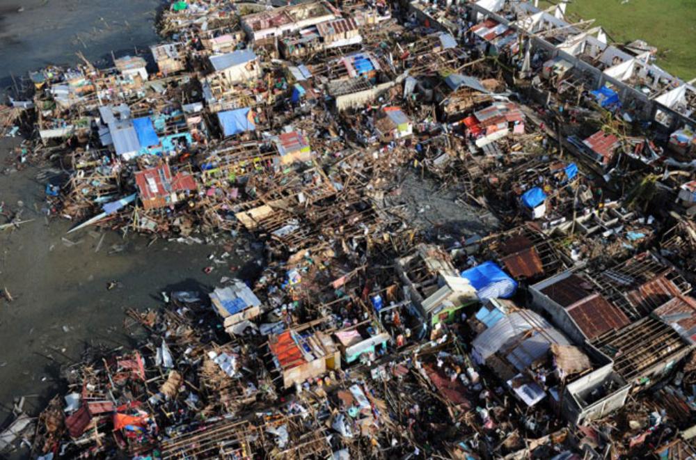
Aerial shots of Guiuan show the extent of the destruction.
|
These photos of Guiuan, in southeastern Samar, show the true scale of the devastation. |
/AFP PHOTO / TED ALJIBE
The true scale of Super Typhoon Haiyan can be seen from the air.
/AFP PHOTO / TED ALJIBE
The town of Guiuan is situated on a spit of land in the southeast of Samar Island.

/AFP PHOTO / TED ALJIBE
The town was severely damaged by the super typhoon, and aid may take several days to reach the survivors.
/AFP PHOTO / TED ALJIBE
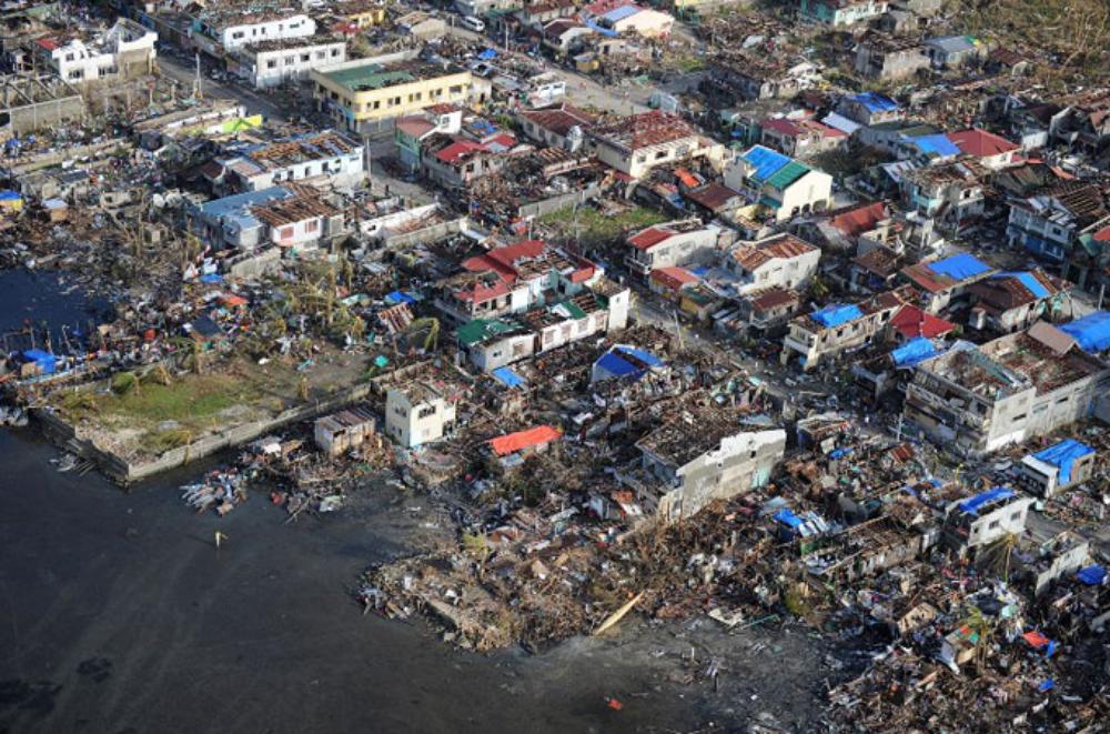
Guiuan is to the east of Tacloban and saw some of the worst conditions of the storm.

/AFP PHOTO / TED ALJIBE
The city was devastated by winds of approximately 300 kph, and a storm surge of over 5 metres.
/AFP PHOTO / TED ALJIBE
 Although the residents were advised to evacuate, a number of people stayed to protect their homes. Although the residents were advised to evacuate, a number of people stayed to protect their homes.
/AFP PHOTO / TED ALJIBE
The storm surge that pushed across land was like a tsunami, and bulldozed everything in its path.

/AFP PHOTO / TED ALJIBE
After the flood waters recede, everything is coated with a thick film of mud.

/AFP PHOTO / TED ALJIBE
With their homes destroyed, survivors assemble makeshift tents whilst they wait for help on Victory Island, near Guiuan.

/AFP PHOTO / TED ALJIBE
It will take many more days before aid finally starts to trickle through to all those who are in desperate need of help.
|
Tuesday, 12 November 2013
Subscribe to:
Post Comments (Atom)
No comments:
Post a Comment